Why Seepage Assessment Matters
Seepage is an important factor to consider when inspecting dams, river dikes and earth embankments. Water moving through or beneath an embankment may be part of normal seepage behavior, but changes in seepage location, flow, clarity or surrounding ground conditions can indicate a developing problem.
A single wet patch does not necessarily mean that a dam or embankment is unsafe. Rainfall, surface drainage, irrigation and nearby water sources can also create wet ground. The purpose of a seepage assessment is to document these observations, identify unusual patterns and determine whether further investigation is needed.
A structured inspection helps engineering teams compare conditions over time and decide where to carry out additional measurements or obtain specialist advice.
2. Establish a Baseline Before Field Inspection
Before conducting a detailed inspection, collect the available information about the structure and its surroundings.
Review previous inspection reports, maintenance records, repair history, construction drawings and any available seepage measurements. If water levels, drainage conditions or seepage observations have been recorded previously, use them as a reference when evaluating current conditions.
During the initial site visit, document the weather, recent rainfall, nearby water levels and visible changes in the surrounding ground. These details can help distinguish a new observation from a condition that has existed for some time.
Where possible, use a consistent inspection route, location references and photographic viewpoints. Consistent records make it easier to compare observations between inspections.
3. Identify and Map Visible Seepage Indicators
Inspect the accessible areas of the upstream and downstream slopes, the embankment toe, drainage outlets and nearby ground. The inspection should follow the site's safety procedures and access restrictions.
Look for changes such as:
Persistent wet areas that cannot be readily explained by rainfall or surface drainage.
New or increasing water discharge at the embankment toe or drainage outlets.
Cloudy water or visible soil particles in seepage discharge.
Localized erosion, small sinkholes or changes in ground level.
New cracks, settlement or deformation near a suspected seepage area.
Changes in existing seepage locations or drainage performance.
Record the position, approximate extent, visible characteristics and time of each observation. Photographs should include a location reference where practical.
These indicators do not independently establish the cause or severity of a problem. Their significance depends on the structure, local geology, drainage arrangements and changes observed over time.
4. Distinguish Seepage from Other Sources of Moisture
Wet ground near a dam or embankment can have several possible causes. Before attributing it to seepage through the structure, consider alternative explanations.
Recent rainfall may cause temporary ponding or runoff. Damaged surface drains, leaking utility pipes, irrigation systems and discharge from nearby facilities can also create localized wet areas. Natural springs or seasonal groundwater changes may contribute to the observed conditions.
Compare the location of the wet area with the drainage layout, nearby infrastructure and recent weather. Check whether the moisture persists after surface water has drained away, and compare it with earlier site records where available.
If the source remains uncertain, document the competing explanations and arrange further investigation rather than treating the initial observation as a confirmed leakage path.
5. Use Instrument Surveys to Support the Investigation
When visual inspection and existing records are insufficient, an appropriate instrument survey may help investigate suspected seepage areas.
The method should be selected according to the structure, site conditions, investigation objective and equipment capabilities. Depending on the project, the investigation may involve surface observations, drainage measurements, geophysical surveys or other methods selected by qualified engineering personnel.
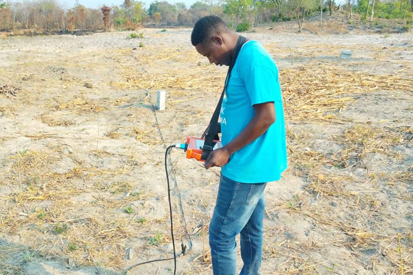
Before measurement, define the area of interest and record the survey positions. Follow the instrument manufacturer's operating instructions and document relevant field conditions. If repeat measurements are required, keep the measurement procedure as consistent as practical.
Instrument responses should be interpreted alongside geological information, structural details and visible site conditions. An anomaly may indicate a change in subsurface properties, but it does not automatically confirm a leakage channel or establish the severity of a defect.
Where the findings could affect dam or embankment safety, the results should be reviewed by qualified personnel and combined with other appropriate evidence.
6. Verify Suspected Seepage and Prioritize Follow-Up
After the initial inspection or instrument survey, review the observations to determine which locations require further attention.
Give priority to conditions involving visible soil transport, increasing discharge, new deformation, unexplained changes in seepage or other signs that may indicate a developing stability problem. Follow the site's emergency procedures and notify the responsible engineering or dam-safety personnel when serious warning signs are observed.
For less urgent findings, arrange repeat observations or additional measurements as appropriate. Compare new records with the baseline and check whether the suspected feature is persistent, expanding or changing.
The follow-up plan should identify the location, observation, supporting evidence, uncertainty and recommended action. Avoid assigning a definitive cause before the available evidence supports that conclusion.
If a potential safety issue is identified, instrument testing must not delay immediate protective measures or professional assessment.
7. Document Findings for Maintenance and Future Inspections
A useful seepage inspection report should make it possible for another engineer to understand what was observed, where it occurred and why further action was recommended.
Include the inspection date, weather conditions, water levels where available, inspection locations, photographs, instrument details if used, measurement records and the interpretation of the findings.
Separate direct observations from technical interpretations. For example, record “persistent wet ground near the downstream toe” as an observation, while treating “possible seepage from the embankment” as an interpretation that may require verification.
The report should also record previous repairs, follow-up measurements and any changes made after the inspection. This creates a consistent record for maintenance planning and future condition assessments.

8. Selecting Equipment for Seepage Investigation
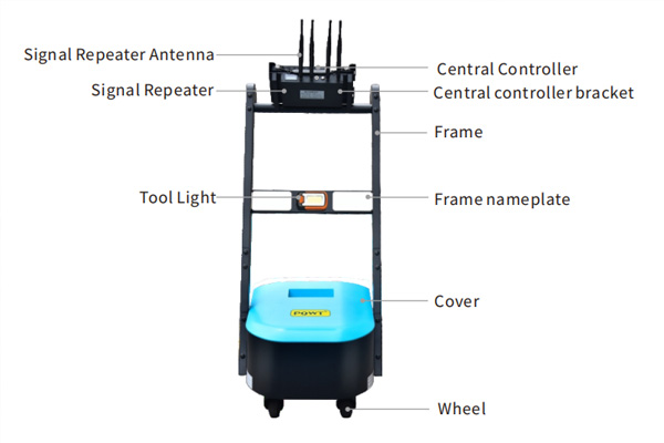
The PQWT 227A Dam Leakage Detector is designed for seepage and leakage investigations involving hydraulic structures, including river embankments, reservoirs and dams. It uses a natural electric field frequency-selection method to measure and analyze potential-difference variations associated with subsurface conditions.
During a field investigation, the PQWT 227A can support the assessment of suspected seepage zones and help identify areas that warrant closer examination. Survey results should be interpreted in conjunction with site observations, geological information and the structural characteristics of the dam or embankment.

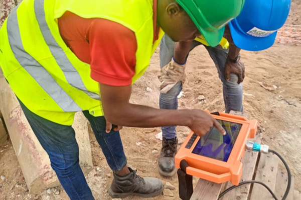
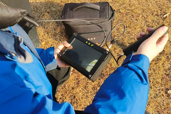
A practical workflow includes documenting the site conditions, defining survey locations, carrying out measurements according to the instrument's operating instructions, reviewing the resulting profiles and verifying significant anomalies where necessary. The findings can then support follow-up inspection and maintenance planning.
The PQWT 227A is an investigation tool, not a substitute for a comprehensive dam-safety assessment. Where signs of serious seepage, soil erosion or structural deformation are observed, qualified engineering personnel should evaluate the findings and determine the appropriate response.