Aquifers in nature are complex systems whose characteristics vary according to different environmental conditions and geological structures. In order to better study and understand the characteristics of aquifers, it is necessary to classify them. The following are classifications of aquifers according to different perspectives:

I. Classification according to the type of voids in the water-bearing medium
According to the types of voids of water-bearing medium, aquifers can be divided into the following three categories:
1. Pore aquifer: This type of aquifer mainly contains loose sediments, such as gravel aquifer and various sand aquifers. These sediments usually have high porosity and permeability and are therefore capable of effectively storing and transferring water.
2. Fissure aquifer: This type of aquifer is mainly composed of various hard rocks, such as sandstone fissure aquifer, gneiss weathering fissure aquifer and basalt nodular fissure aquifer. In the process of formation or after being subjected to external stress, these rocks will form various fissures and joints, which are capable of storing and transferring water.
3. Karst aquifer: This type of aquifer is an aquifer formed by the development of the soluble rock layer solution gaps, which is mainly dominated by carbonate rocks, such as limestone and dolomite constituting the karst aquifer. In China, this type of aquifer is widely distributed, and its solution gaps and cavities can effectively store and transfer water.
II. Divided according to the burial conditions and hydraulics of aquifers
According to the burial conditions and hydraulics of aquifers, aquifers can be divided into two categories:
1. Pressurized aquifer: This type of aquifer is a fully saturated aquifer located between two impermeable or weakly permeable layers. Since its internal pressure is greater than one atmosphere, it is called a confined aquifer. In a pressurized aquifer, water can penetrate upward or downward under pressure, and thus it often has high permeability and good water storage capacity.
2. Unconfined aquifer: This type of aquifer refers to an aquifer in which the pressure on the water surface is equal to one atmospheric pressure, i.e. an aquifer with a free water surface. Above the free water surface of an unpressurized aquifer may be a permeable layer, a weakly permeable layer or a water barrier. Since its internal pressure is equal to the atmospheric pressure, water is infiltrated and stored mainly by gravity.
Third, according to the spatial variation of permeability division
In the hydrogeological calculation, it is often used to divide the aquifer according to the change of permeability of rocks.
1. Homogeneous aquifer: this type of aquifer means that the permeability of each part of it has nothing to do with spatial coordinates and is a constant. Examples are thick sand aquifer in coastal plain phase and thick sand aquifer in river alluvial phase. Although absolutely homogeneous aquifers do not exist in nature, they are often regarded as homogeneous aquifers for calculation and research from the practical point of view.
2. Non-homogeneous aquifer: Most aquifers in nature are non-homogeneous aquifers, i.e. the permeability changes in space. This change can be gradual or sudden, and the form is very complicated. For any point in the aquifer, it can be isotropic or anisotropic. In order to facilitate the research and calculation, the non-homogeneous aquifer which does not change very much is often regarded as homogeneous aquifer or macro-homogeneous aquifer, or the non-homogeneous nature of the aquifer is subdivided into pieces according to a certain order of magnitude, and each piece is regarded as a homogeneous aquifer to be handled.

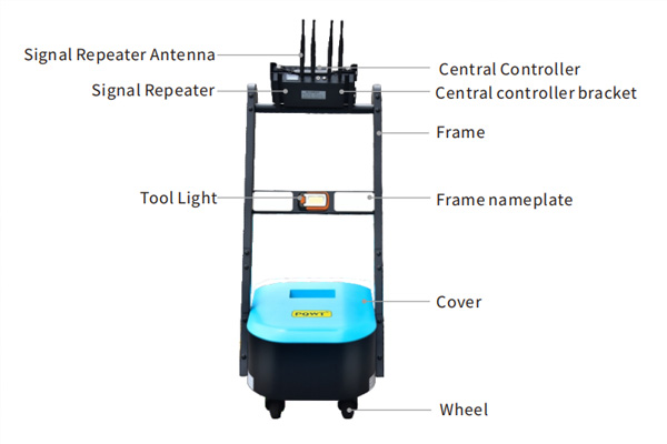
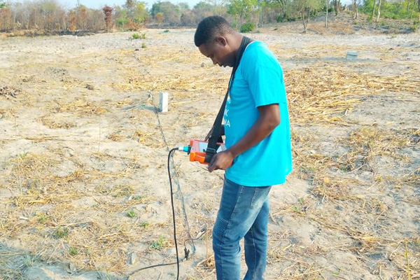
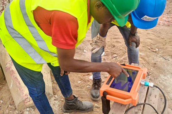
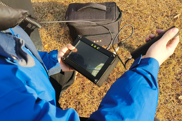
Hunan pqwt Research Institute GT series of automatic mapping water finder is based on the electromagnetic field of the earth as the field source, based on the electrical conductivity differences of different underground geological structures, through the measurement of the pattern of change of the electric field components at different frequencies, to study the geological structure and changes in the situation, scientific search for groundwater resources geologic tectonic changes in the situation through the curve graphs show in real time. A simple one-key operation automatically generates the geological profile, getting rid of the cumbersome computerized mapping. On the spot, you can quickly understand the geological structure and analyze the specific information of aquifers, fissures, faults, caves, etc. The instrument is widely used in different terrains, such as plains, hills, mountains, plateaus, basins, etc. to quickly analyze the changes in geological structure and determine the location of the wells, aquifers, and the depth of the aquifers.