1. Why Groundwater Survey Planning Matters
Drilling a water well requires decisions about where to investigate, which areas deserve closer attention, and how to evaluate the available geological information. A poorly planned survey may lead to unsuitable drilling locations, unnecessary costs, or additional investigation work.
Groundwater exploration should therefore begin before drilling equipment arrives on site. Reviewing existing information, understanding local terrain, and defining the survey objectives help establish a more structured approach to site assessment.
A groundwater survey can help identify areas that warrant further investigation, but it cannot guarantee that a proposed well will produce a particular volume of water. Final drilling decisions should consider geological evidence, local hydrogeological conditions, water quality requirements, and the intended use of the well.

2.Collect Site Information Before the Survey
Before conducting field measurements, gather as much relevant site information as possible.
Review existing well records. Information about nearby wells may provide useful context, including reported drilling depths, water levels, geological formations, and available pumping-test results. Records should be checked for reliability and relevance to the proposed site.
Understand the local geology. Geological maps, terrain features, exposed rock, and known faults can help investigators develop an initial understanding of the area. However, geological similarities between two locations do not guarantee identical groundwater conditions.
Identify access and land-use constraints. Record property boundaries, roads, buildings, existing utilities, protected areas, and possible drilling access routes. These factors can influence where measurements can be taken and where drilling may be feasible.
Define the water requirement. Clarify the intended use of the well, expected demand, seasonal requirements, and any applicable water-quality standards. These requirements help determine what information the survey needs to provide.
3. Conduct a Preliminary Site Inspection
A site visit helps the survey team compare existing records with actual field conditions.
Observe changes in elevation, drainage patterns, exposed geological features, and nearby water sources. Note whether access is restricted by buildings, vegetation, steep slopes, or other obstacles.
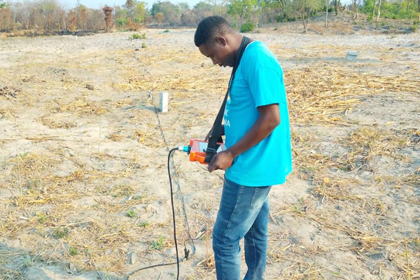
The team should also identify potential sources of interference or practical limitations that could affect measurement quality. Depending on the selected survey method, these may include electrical infrastructure, metal structures, difficult terrain, or limited space for instrument deployment.
Document the observations with site photographs, location records, and field notes. This information provides context for later interpretation and helps explain why certain measurement locations were selected.
Surface features can guide the investigation, but they should not be treated as conclusive evidence of groundwater availability.
4.Design Survey Lines and Measurement Points
Survey-line design should reflect the investigation objective, the size of the site, the terrain, and the capabilities of the selected instrument.
Start by defining the area that needs to be investigated. Where appropriate, establish a main survey line across the target area and add cross-lines to examine whether the observed pattern continues in another direction.
Measurement spacing should be selected according to the instrument's technical requirements, the expected scale of the geological features, and the level of detail needed. A fixed spacing is not suitable for every project.
Record the coordinates or positions of measurement points consistently. If several lines are surveyed, use a clear numbering system so that the results can be compared and interpreted together.
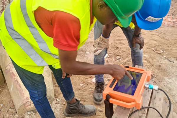
Before collecting the main dataset, check the equipment setup and confirm that the measurement procedure follows the manufacturer's instructions. If field conditions change significantly, document the change rather than comparing the measurements as though they were collected under identical conditions.
5. Interpret Survey Results with Geological Context
Instrument readings should be interpreted alongside geological information and field observations. An anomaly may indicate a change in subsurface properties, but it does not automatically identify a productive aquifer.
Depending on the instrument and method used, the observed response may be influenced by soil and rock composition, moisture distribution, groundwater salinity, fractures, buried structures, and other subsurface conditions.
A more defensible interpretation considers several questions:
Is the observed feature consistent across adjacent measurement points or survey lines?
Does the pattern make sense in relation to the known geology?
Could alternative subsurface conditions explain the same response?
Is additional measurement or independent geological evidence needed?
What level of uncertainty remains before selecting a drilling target?
The objective is to develop a reasoned interpretation of potential groundwater-bearing structures, not to treat every anomaly as proof of a water source.
6. Turn the Survey into a Drilling Decision
After reviewing the survey results, prepare a site assessment that distinguishes between the observations, the interpretation, and the recommended next steps.
The assessment should identify the locations that warrant further investigation, summarize the evidence supporting each location, and describe the main uncertainties. If multiple candidate locations are available, compare them against geological evidence, access conditions, drilling feasibility, expected water demand, and project constraints.
Where the evidence is incomplete, additional field measurements, geological consultation, or other appropriate investigations may be needed before drilling begins.
Once a drilling target has been selected, the drilling program should be planned according to local geological conditions and professional drilling practices. During drilling, actual geological formations and water-bearing intervals should be recorded and compared with the original interpretation.
This feedback helps evaluate the survey and improve future site-selection decisions.
7. Choosing Groundwater Survey Equipment
Groundwater survey equipment should be selected according to the project objective, site conditions, and the information required from the survey.
Before choosing a groundwater detector, review the manufacturer's stated measurement method, operating procedure, applicable conditions, and limitations. Confirm that the instrument is appropriate for the intended investigation rather than assuming that every model provides the same depth range, output, or interpretation capabilities.
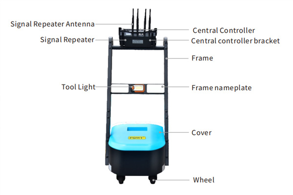
For example, PQWT offers groundwater detection and geophysical survey equipment in different product series. Buyers should compare the specifications of the individual models and determine whether the available functions meet their project requirements.
Explore the PQWT underground water detector product range to review available models and their stated applications.
Equipment is one part of the survey process. Reliable site assessment also depends on appropriate survey planning, field procedures, geological interpretation, and follow-up verification.
Conclusion
Planning a groundwater survey before drilling helps organize fieldwork, improve the interpretation of available evidence, and make drilling decisions more systematic.
A sound process begins with site information and preliminary inspection, continues through survey-line planning and data interpretation, and ends with a documented assessment of candidate drilling locations.
Groundwater detection equipment can support this process when its capabilities match the project requirements. However, survey results should be evaluated alongside geological information and verified against actual drilling conditions.
For groundwater exploration projects, review the available PQWT equipment specifications and select a solution suited to the site, the survey objective, and the intended well use.