A ground water detector is a device used to determine the location of a groundwater source, and by using this device you can improve the accuracy of well drilling, reduce blindness, and increase the efficiency of well drilling. In this article, we will describe ways to use the ground water detector to improve the accuracy of well drilling.

I. Understanding the geology
Before drilling a well, it is necessary to fully understand the geology of the target area. This includes information such as stratigraphic distribution, lithological characteristics, and geological structure. This information can help us better choose the right location for drilling, and better understand the meaning of the readings when using ground water detector.
Choosing the right equipment
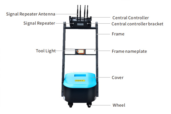
There are many types of ground water detector, and different devices are suitable for different geological conditions and depths. It is necessary to choose the appropriate equipment according to the specific conditions of the target area. At the same time, the accuracy and reliability of the equipment are also factors to be considered.
Operation steps
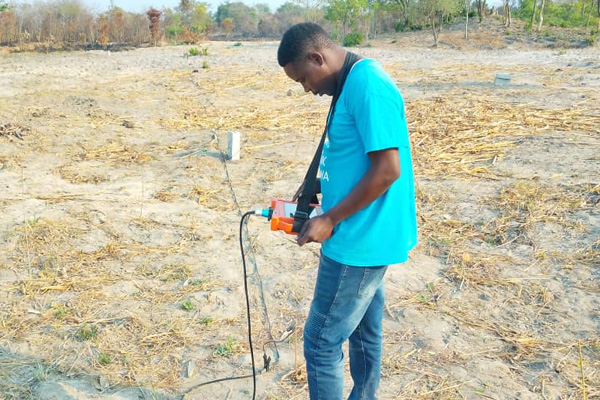
1、Wiring. In the area to be measured in a straight line wiring, according to the selected number of measurement points placed in the cable length and electrode rod, keep the electrode rod and cable contact is good, the electrode grounding normal. The number of measurement points = electrode rod - 4, when you need to measure 10 measurement points, you need to place 14 electrode rods. The host collects data from the center of the M and N poles, the center of M1 and N1 is the first measurement point P1, i.e. the position of the third electrode rod, the center of M2 and N2 is the second measurement point P2, i.e. the position of the fourth electrode rod, and so on. Up to 18 points can be measured at one time.
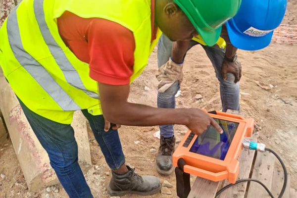
2, parameter setting: the instrument is powered on to enter the operating interface, the first step, line detection, measuring line connected to the host. Long press the line detection light, observe the line indicator at the bottom of the screen, all the indicator lights indicate that the line is normal. The second step, click on the profile and then click on the measurement parameter settings, measurement line number settings; each place must be measured to replace the measurement line number, such as the first line measured, measured the next one will have to change the measurement line 1 into the measurement line 2, and then change the place to change the measurement line 3, and so on. Step 3: Points setting, according to the actual number of connected electrode rods minus 4 is the actual number of measurement points, such as only 20 electrode rods inserted, the actual number of measurement points is 20-4 = 16 points. Step 4: Depth setting, click depth, adjust to the corresponding depth you need to measure. (The increment and point number in the interface of the instrument generally do not need to be set, and the gain is normally defaulted to 0.)
3, after the completion of parameter settings click on OK, and then click on the collection to start collecting data, the bottom of the screen has a blue progress bar display, there are beeps prompting the collection of data to complete, respectively, click on the screen curve, profile, 3D map, and auxiliary analysis, you can view the results according to the actual situation of the results you want to see the map and analyze the results of the measurements on-site.
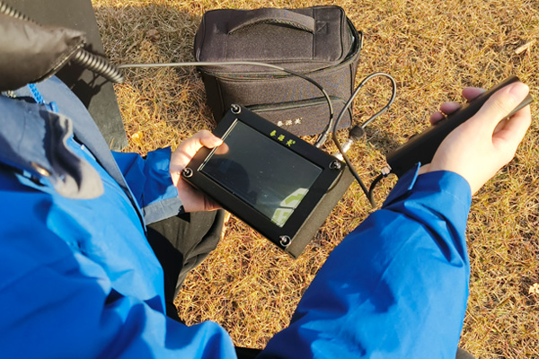
4、Re-measurement method: After we finish measuring a line, in order to verify the authenticity of the data and the extension of the tectonic anomalies and scale, we usually re-measure a parallel line 5 meters away from the side of the original measurement line, compare the results of the two measurements to confirm whether the measurement results are true and whether the data collection is effective, analyze the geological structure through the curve and profile combined with the measurement data, stratigraphic lithology and so on, analyze whether there are any water storage structures and conditions. Analyze whether there are water storage structures and conditions to determine the well location.